%2016-05-2016.jpg)
Gambia
Map

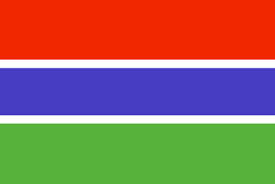
Flag
General Information
| Full name: | Islamic Republic of The Gambia |
| Capital City: | Banjul |
| Population | 1.849 million (2013) |
| Area | 10,689 km² |
| Borders | Senegal by land and Cape Verde by sea. |
| Coastline | 80 km |
| Language: | English, Wolof, Fula, Mandingo |
| Currency: | Dalasi (D) |
| Country Code | +220 |
| Time Zone | UTC (GMT) |
| Literacy | 52.1% |
| Language | English, Wolof, Fula, Mandingo |
| Newspaper: | Daily Observer, The Gambia Daily News, The Point Newspaper |
| Places to Visit: | Banjul, Serekunda, Abuko Nature Reserve, Kartong, Wassu Stone Circles |
| Climate | Subtropical climate with distinct dry and rainy seasons |
| Major Religion | Muslim, Christian and others |
Trade Facts
In 2014, the Gambia exported $214M and imported $1.14B, resulting in a negative trade balance of $927M. In 2014 the GDP of the Gambia was $850M and its GDP per capita was $1.63k.
The top exports of the Gambia are:
Artificial Filament Yarn Woven Fabric ($60.9M), Coconuts, Brazil Nuts, and Cashews ($45M),Rough Wood ($29.9M), Fuel Wood ($7.49M) and Scrap Iron($6.41M).
The top export destinations of the Gambia are:
China ($41.7M),Mali ($39.3M), India ($36.2M), Guinea ($25.8M) and Senegal($17.9M).
Its top imports are:
Light Pure Woven Cotton($179M), Rice ($67.9M), Raw Sugar ($53.3M), Palm Oil ($47.4M) and Refined Petroleum ($38.6M).
The top import origins are:
China ($334M), Brazil ($96.4M), Senegal ($91.6M), India ($89.7M) and Indonesia ($51M).
_____________________________
Educational Institutes
UNIVERSITY OF THE GAMBIA
Address: University of The Gambia, Kanifing, P.O. Box 3530 - Serrekunda, Gambia
http://www.unigambia.gm
Places to See!

Kotu Beach

Niumi National Park

Senegambia Beach Pool
_____________________________
The Gambia: Africa's new Islamic republic
[December 2015]

President Yahya Jammeh
_____________________________
South-east Asia migrant crisis: Gambia offers to resettle all Rohingya refugees.
[May 2015]

_____________________________